MAPS
A map is a symbolic display of different elements and their relationship to each other. They help the visitor to orient themselves with the features of your venue, provide historical context, or find treasure. Most maps are flat and printed on paper or used online. However, we can also make maps in 3D by adding layers of material. Created with Adobe Illustrator.
Niagara County Fairgrounds
Created for inclusion in their brochure to assist with fairground navigation. Each year the map is updated to include new and exciting attractions.

Niagara Rises
Planning map for the Tails, Troops & Tunes event hosted by Niagara Rises. The map was also used day of to place the attractions as they arrived on site.

Gratwick Waterfront Park
Created as a planning map for a music festival.


Lockport Locks District
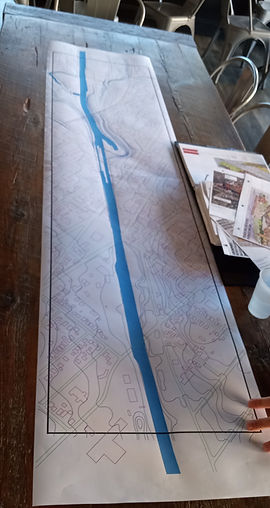
Created as a planning map for a model construction project. Included topography and building locations.
Lockport Heritage Tours
Created to promote this portion of the Empire State Trail. Featuring the decorative flower beds at each intersection.

Wilson Harbor
Created as part of a local history project.

Lockport Topography
Originally created to determine the scope of a historic model project.

MODELS
Are a great way to showcase a new building, add a custom feature to your railroad layout, or to preserve the appearance of a historic structure. These are created with a variety of materials, supplies and techniques.
NY Central Lockport Station
This is the archway portion of a former train station. Created as a materials test to see what would be required to complete the entire building. Foamboard and Insulation foam. Carved and painted by hand. 15x15 inches.

Castle
Created for a themed wedding. The main roof was left open at the peak to drop envelopes inside. The draw bridge opened and closed. Foamboard walls, construction paper shingles, 4x3x5 feet.

Cardboard Model Prototype
This is a prototype for a much larger project. Amazing what you can do with Q-tips and guitar strings.

Model Painting
These plastic model kits (12 in all) came preassembled from the client. My task was to paint them as they appear on the box for display in his model railroad layout.


